Dangerous Weather
January 24, 2019
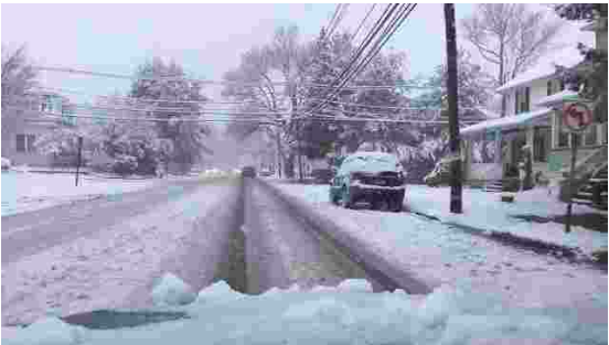
New Jerseyans prepared to hunker down and grab their shovels this weekend as a large blizzard was expected to hit the state over the weekend. Projected to begin early Friday morning and come in waves throughout the coming days, citizens watched their thermometers drop and roads be salted. However, all that came was one nominal snowfall Saturday evening, which turned into rain and slush in Sunday’s high-thirties temperatures.
No, instead of a blizzard, New Jersey received a thorough coating of ice, with melted runoff from the weekend storm freezing solid in the frigid, single-digit polar drop which struck Monday. Large swaths of thick ice dotted the roads, and some businesses and schools were shut down in more heavily-hit areas, although many were already off for the 2019 celebration of Martin Luther King Jr. Day. Bernards Township School District, for example, shifted their half-day schedule to a delayed opening, giving local plows and salters extra time to clear the ice.
Memories of the November blizzard which blindsided the Northeast occupied the back of everyone’s minds as they prepared for the Nor’Easter. In November, many students and commuting workers were trapped in their schools, offices or in vehicles, paralyzed by the snowfall. Some did not reach home for more than eight hours in that storm, and so this time many townships intentionally over-prepared for what was coming. Major highways such as Interstates 287 and 78 were salted and brined thoroughly by Thursday evening to prevent another disaster.
As temperatures continue to hang in the single digits this Tuesday, large ice sheets still frame the roads. Though most businesses and schools have reopened, drivers are still moving cautiously and citizens are urged to stay indoors whenever possible.